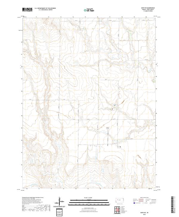
2022 Map of Gove SW
USGS Topo · Published 2022About this map
The Smoky Hill River meanders across the southern reach of this Western Kansas landscape, carving a wide valley through the High Plains. This area of Gove County is defined by a systematic grid of section lines and county roads, reflecting the enduring township and range survey system. Small watercourses like Indian Cr in the north and Plum Cr in the south drain the higher tablelands toward the river basin. While the terrain is largely agricultural, the presence of the Coberly Airport provides a distinct aviation landmark amid the expansive fields. The map documents the persistent infrastructure of rural life, tracing essential corridors such as Co Rd M and Gove 52 that link isolated farmsteads and ranch lands across the Gove SW quadrangle.
Find a feature on this map
25 named features on this map. Tap any name to fly to it.
Don’t see what you’re looking for? This feature index may not catch every label — zoom into the map to look around manually.
Map Details
Editions of this 2022 Gove SW Map
This is the sole edition of this map. No revisions or reprints were ever made.
Other maps of this area

1955 · Scott City
USGS Topo · 1:250,000

1958 · Scott City
USGS Topo · 1:250,000

1972 · Gove NE
USGS Topo · 1:24,000

1972 · Orion NE
USGS Topo · 1:24,000

1972 · Gove
USGS Topo · 1:24,000

1974 · Cheyenne Creek
USGS Topo · 1:24,000

1974 · Gove SW
USGS Topo · 1:24,000

1974 · Gove SE
USGS Topo · 1:24,000
1974 · Orion SE
USGS Topo · 1:24,000

1974 · Shields NW
USGS Topo · 1:24,000