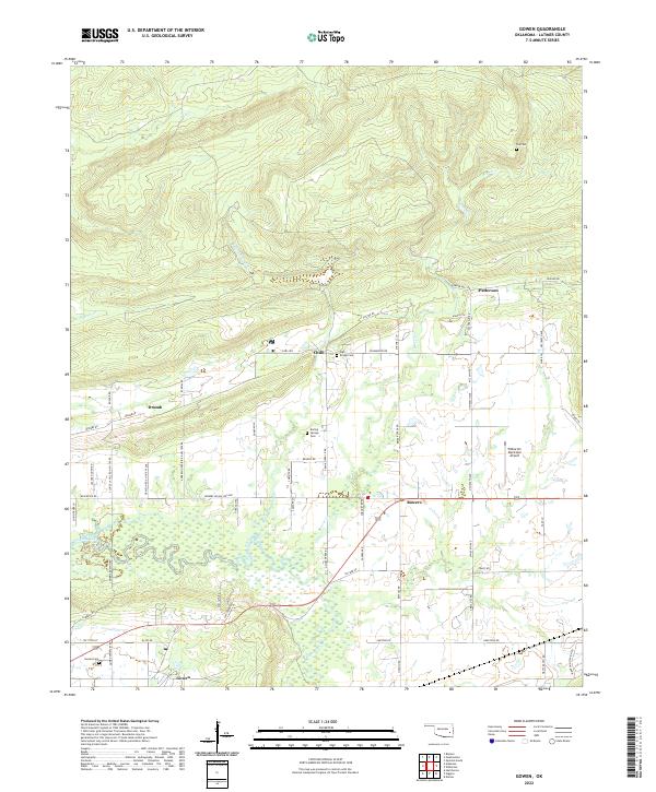
2022 Map of Gowen
USGS Topo · Published 2022About this map
Gaines Creek and its many meandering tributaries dominate this Latimer County landscape, where the flatlands of the creek basin meet rising upland terrain. Small rural settlements like Gowen, Bowers, and Patterson are connected by a network of local roads such as Patterson Rd and Gaines Creek Rd. This modern survey illustrates how these communities remain centered around historical markers of local identity, including the Gowen Cem, Boiling Springs Cem, and the remote Tea Cem to the northeast. The presence of the Wilburton Municipal Airport near the eastern boundary signifies the integration of modern infrastructure into this traditionally agricultural area. The map's detailed hydrography, showing Boiling Springs Cr and Beaver Cr, highlights the importance of water management in a region characterized by seasonal wetlands and significant elevation changes.
Find a feature on this map
72 named features on this map. Tap any name to fly to it.
Don’t see what you’re looking for? This feature index may not catch every label — zoom into the map to look around manually.
Map Details
Editions of this 2022 Gowen Map
This is the sole edition of this map. No revisions or reprints were ever made.
Other maps of this area

1898 · McAlester
USGS Topo · 1:125,000

1900 · Sansbois
USGS Topo · 1:125,000

1900 · Canadian
USGS Topo · 1:125,000

1901 · Tuskahoma
USGS Topo · 1:125,000

1908 · Tuskahoma
USGS Topo · 1:125,000

1909 · Mc Alester
USGS Topo · 1:125,000

1909 · Tuskahoma
USGS Topo · 1:125,000

1909 · Sans Bois
USGS Topo · 1:125,000

1911 · Sansbois
USGS Topo · 1:125,000

1946 · Fort Smith
USGS Topo · 1:250,000