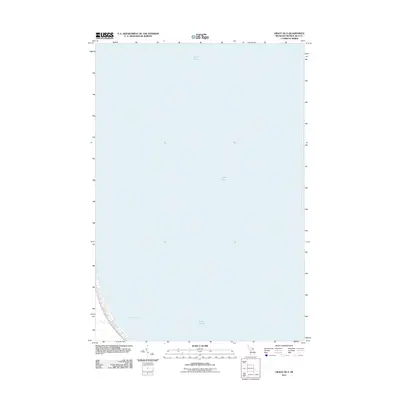
2011 Map of Grace OE E
USGS Topo · Published 2011About this map
Lake Huron dominates this nautical-heavy survey of the Michigan shoreline in Presque Isle County. The map focuses primarily on the open waters of the Great Lakes, with the southwestern corner capturing a section of the coast along Hammond Bay. This coastal curve reveals the underwater topography and shoreline elevation of Bearinger Township, providing a clear record of the lakefront as it existed in 2011. While largely an aquatic sheet, the map serves as a specialized reference for the maritime reaches of the Grace OE E quadrangle, documenting the relationship between the northern Michigan landmass and the vast expanse of the Huron basin.
Find a feature on this map
2 named features on this map. Tap any name to fly to it.
Don’t see what you’re looking for? This feature index may not catch every label — zoom into the map to look around manually.
Map Details
Editions of this 2011 Grace OE E Map
This is the sole edition of this map. No revisions or reprints were ever made.
Other maps of this area

1954 · Alpena
USGS Topo · 1:250,000

1955 · Cheboygan
USGS Topo · 1:250,000

1957 · Alpena
USGS Topo · 1:250,000

1957 · Onaway
USGS Topo · 1:62,500

1958 · Cheboygan
USGS Topo · 1:250,000

1958 · Alpena
USGS Topo · 1:250,000

1958 · Grace
USGS Topo · 1:62,500

1969 · Alpena
USGS Topo · 1:250,000
1971 · Moltke
USGS Topo · 1:24,000

1982 · Petoskey
USGS Topo · 1:100,000