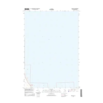
2014 Map of Grace OE E
USGS Topo · Published 2014About this map
Lake Huron dominates this nautical-focused survey, showcasing the expansive waters and shoreline of Presque Isle County. The coastal landscape is defined by the sweeping curve of Hammond Bay, where the land meets the Great Lakes at the edge of Bearinger Township. This 2014 edition highlights the critical transportation corridor of Us-23, which tracks the shoreline and serves as the primary artery for the region. The map provides a clear view of the Public Land Survey System grid, including township and range lines like t36n r3e, which are essential for property research and understanding the historic division of Michigan’s northern lakefront. This specific coastal area remains relatively sparse, focusing on the interface between the highway and the water's edge.
Find a feature on this map
11 named features on this map. Tap any name to fly to it.
Don’t see what you’re looking for? This feature index may not catch every label — zoom into the map to look around manually.
Map Details
Editions of this 2014 Grace OE E Map
This is the sole edition of this map. No revisions or reprints were ever made.
Other maps of this area
1954 · Alpena
USGS Topo · 1:250,000
1955 · Cheboygan
USGS Topo · 1:250,000
1957 · Alpena
USGS Topo · 1:250,000
1957 · Onaway
USGS Topo · 1:62,500
1958 · Cheboygan
USGS Topo · 1:250,000
1958 · Alpena
USGS Topo · 1:250,000
1958 · Grace
USGS Topo · 1:62,500
1969 · Alpena
USGS Topo · 1:250,000
1971 · Moltke
USGS Topo · 1:24,000
1982 · Petoskey
USGS Topo · 1:100,000