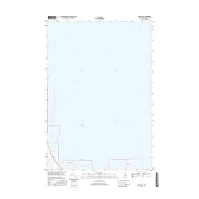
2017 Map of Grace OE E
USGS Topo · Published 2017About this map
Lake Huron dominates this 2017 topographic study of a coastal stretch in Presque Isle County. The shoreline transition is marked by the sheltered waters of Hammond Bay, where the land meets the Great Lakes at the northern edge of the Lower Peninsula. The map provides a look at the modern terrestrial layout of Township 36 North, Range 3 East, showing the light human footprint on this coastal landscape. Inland access is defined by Pine Tree Trl, which skirts the edge of the bay. This map is primarily a hydrographic and coastal survey, capturing the exact contours and bathymetry of the shoreline at this specific point in the twenty-first century.
Find a feature on this map
4 named features on this map. Tap any name to fly to it.
Don’t see what you’re looking for? This feature index may not catch every label — zoom into the map to look around manually.
Map Details
Editions of this 2017 Grace OE E Map
This is the sole edition of this map. No revisions or reprints were ever made.
Other maps of this area

1954 · Alpena
USGS Topo · 1:250,000

1955 · Cheboygan
USGS Topo · 1:250,000

1957 · Alpena
USGS Topo · 1:250,000

1957 · Onaway
USGS Topo · 1:62,500

1958 · Cheboygan
USGS Topo · 1:250,000

1958 · Alpena
USGS Topo · 1:250,000

1958 · Grace
USGS Topo · 1:62,500

1969 · Alpena
USGS Topo · 1:250,000
1971 · Moltke
USGS Topo · 1:24,000

1982 · Petoskey
USGS Topo · 1:100,000