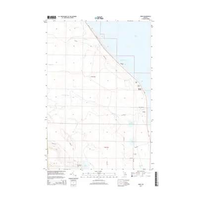
2014 Map of Grace
USGS Topo · Published 2014About this map
Lake Huron defines the northeastern edge of this Presque Isle County coastline, where the small settlement of Grace and the recreational stretch of Huron Beach overlook the water. The landscape is characterized by a dense network of inland waters and slow-moving streams, including the Black Mallard River, which drains Black Mallard Lake toward the coast. Local geography is marked by distinctive coastal landmarks such as Highway Point and Mast Point near Hammond Bay Harbor. For those researching regional genealogy or land use, the map identifies the Black Lake State Forest Cem and Grace Cem, while interior features like Lake Sixteen and Clear Lake suggest the area's transition into the state forest. A grid of local roads, including Mast Point Rd and Beach Hwy, provides access to these lakefront communities and the wooded backcountry.
Find a feature on this map
31 named features on this map. Tap any name to fly to it.
Don’t see what you’re looking for? This feature index may not catch every label — zoom into the map to look around manually.
Map Details
Editions of this 2014 Grace Map
This is the sole edition of this map. No revisions or reprints were ever made.
Other maps of this area

1955 · Cheboygan
USGS Topo · 1:250,000

1957 · Tower
USGS Topo · 1:62,500

1957 · Cheboygan
USGS Topo · 1:62,500

1957 · Onaway
USGS Topo · 1:62,500

1958 · Cheboygan
USGS Topo · 1:250,000

1958 · Grace
USGS Topo · 1:62,500

1982 · Petoskey
USGS Topo · 1:100,000

1982 · Cordwood Point
USGS Topo · 1:25,000

1982 · Grace
USGS Topo · 1:24,000
1982 · Nilemile Point
USGS Topo · 1:25,000