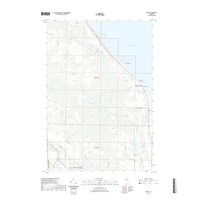
2019 Map of Grace
USGS Topo · Published 2019About this map
Lake Huron defines the eastern edge of this coastal Michigan landscape, where the settlements of Grace and Huron Beach sit along the shoreline of Presque Isle County. The interior is a dense network of forest roads and waterways, characterized by the winding path of the Black Mallard River as it flows toward Black Mallard Lake. This 2019 survey documents the modern layout of the Black Mountain Recreation Area, a significant regional tract of public land interspersed with several inland water bodies like Lake Sixteen and Clear Lake. Local genealogy and history are preserved at sites like Grace Cem near the southern boundary and the State Forest Cem tucked away near the lakeshore. The map provides a clear view of the transition from the protected woodlands of the recreation area to the developed harbor facilities at Hammond Bay Harbor.
Find a feature on this map
41 named features on this map. Tap any name to fly to it.
Don’t see what you’re looking for? This feature index may not catch every label — zoom into the map to look around manually.
Map Details
Editions of this 2019 Grace Map
This is the sole edition of this map. No revisions or reprints were ever made.
Other maps of this area

1955 · Cheboygan
USGS Topo · 1:250,000

1957 · Tower
USGS Topo · 1:62,500

1957 · Cheboygan
USGS Topo · 1:62,500

1957 · Onaway
USGS Topo · 1:62,500

1958 · Cheboygan
USGS Topo · 1:250,000

1958 · Grace
USGS Topo · 1:62,500

1982 · Petoskey
USGS Topo · 1:100,000

1982 · Cordwood Point
USGS Topo · 1:25,000

1982 · Grace
USGS Topo · 1:24,000
1982 · Nilemile Point
USGS Topo · 1:25,000