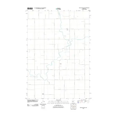
2010 Map of Gracelock NW
USGS Topo · Published 2010About this map
The Chippewa River carves a winding, serpentine path through this agricultural landscape in Chippewa County, joined by the waters of Shakopee Creek. This region is defined by its rectilinear grid of rural roads, including County Hwy-10 and County Hwy-70, which divide the land into neat sections of prairie and farmland. For genealogists and local historians, several vital landmarks are recorded along these routes. The Trinity Cemetery sits near the northern reaches of the river, while further south, the Big Bend Cemetery and Big Bend Lutheran Cemetery reflect the long-standing community centers of the township. The infrastructure of the area is further evidenced by a dense network of local streets such as Chip-Swift St NW and 70th St SW, which facilitate movement across the floodplains and upland fields.
Find a feature on this map
18 named features on this map. Tap any name to fly to it.
Don’t see what you’re looking for? This feature index may not catch every label — zoom into the map to look around manually.
Map Details
Editions of this 2010 Gracelock NW Map
This is the sole edition of this map. No revisions or reprints were ever made.
Other maps of this area

1953 · Saint Cloud
USGS Topo · 1:250,000

1957 · Saint Cloud
USGS Topo · 1:250,000

1958 · Saint Cloud
USGS Topo · 1:250,000

1958 · Gracelock NE
USGS Topo · 1:24,000

1958 · Big Bend City
USGS Topo · 1:24,000

1958 · Watson
USGS Topo · 1:24,000

1958 · Gracelock NW
USGS Topo · 1:24,000

1958 · Gracelock
USGS Topo · 1:24,000

1958 · Gracelock SW
USGS Topo · 1:24,000

1968 · Danvers
USGS Topo · 1:24,000