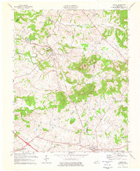
1974 Map of Gracey
USGS Topo · Published 1976About this map
Cerulean and Gracey anchor this 1974 topographic survey along the borders of Christian, Trigg, and Caldwell counties. The landscape is defined by the winding course of the Muddy Fork Little River and its numerous tributaries like Horse Creek and Brushy Fork. This era shows a mature rail network, with the Illinois Central Gulf railroad cutting through the center of the sheet, serving local industrial interests like the Quarry near the western edge. For genealogists, the map is particularly dense with small family and community burial grounds, including the Ladd Cem, Thomas Cem, and McCarroll Hill Cem. The southern portion of the quadrangle transitions into a series of notable elevations like Buffalo Knob and Bule Knob, marking the distinctive terrain of this Kentucky Pennyroyal region.
Find a feature on this map
37 named features on this map. Tap any name to fly to it.
Don’t see what you’re looking for? This feature index may not catch every label — zoom into the map to look around manually.
Map Details
Editions of this 1974 Gracey Map
This is the sole edition of this map. No revisions or reprints were ever made.
Other maps of this area

1908 · Princeton
USGS Topo · 1:62,500

1909 · Dawson Springs
USGS Topo · 1:48,000

1910 · Princeton
USGS Topo · 1:62,500

1911 · Dawson Springs
USGS Topo · 1:62,500

1950 · Caledonia
USGS Topo · 1:24,000

1951 · Church Hill
USGS Topo · 1:24,000

1951 · Caledonia
USGS Topo · 1:24,000

1952 · Pleasant Green Hill
USGS Topo · 1:24,000

1953 · Dawson Springs SE
USGS Topo · 1:24,000

1953 · Gracey
USGS Topo · 1:24,000