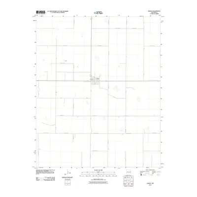
2010 Map of Grady
USGS Topo · Published 2010About this map
The high plains of Grady in Curry County are defined by an expansive grid of agricultural roads and sparse settlements. This 2010 survey illustrates the town of Grady as the primary hub, where the Grady Post Office serves as a central landmark for the surrounding rural community. The landscape is marked by a distinctive system of thoroughfares that transition between county lines, such as Quay Road R and Quay Road P, reflecting the organized land management of eastern New Mexico. Scattered locations like Delaney and Ware appear as small points of activity along the rectilinear network of Curry Road 40 and County Rd 41. Small, ephemeral water features are visible across the plains, dotting the terrain between the vast sections of farmland.
Find a feature on this map
28 named features on this map. Tap any name to fly to it.
Don’t see what you’re looking for? This feature index may not catch every label — zoom into the map to look around manually.
Map Details
Editions of this 2010 Grady Map
This is the sole edition of this map. No revisions or reprints were ever made.
Other maps of this area

1954 · Clovis
USGS Topo · 1:250,000

1957 · Pleasant Hill
USGS Topo · 1:62,500

1957 · Hammond Ranch
USGS Topo · 1:62,500

1958 · Clovis
USGS Topo · 1:250,000

1971 · Day Canyon
USGS Topo · 1:24,000
1971 · Apache Canyon
USGS Topo · 1:24,000

1971 · Wheatland
USGS Topo · 1:24,000

1971 · Broadview
USGS Topo · 1:24,000

1971 · Grady
USGS Topo · 1:24,000

1971 · Grady SW
USGS Topo · 1:24,000