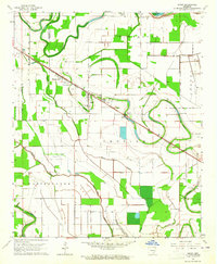
1964 Map of Grady
USGS Topo · Published 1965About this map
Grady serves as the primary hub of this Arkansas Delta landscape, situated along the Missouri Pacific railroad. The town is surrounded by a dense network of country churches and family burial grounds, reflecting the deep-rooted social fabric of the mid-20th century. Notable local landmarks include Mt Zion Ch, New St James Zion Ch, and several cemeteries such as McBride Cem and Gocio Cem. To the east, the State Prison Farm occupies a significant portion of the river bottomlands near the oxbow curves of the local waterways.
Find a feature on this map
38 named features on this map. Tap any name to fly to it.
Don’t see what you’re looking for? This feature index may not catch every label — zoom into the map to look around manually.
Map Details
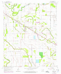
Editions of this 1964 Grady Map
2 editions found
Other maps of this area

1935 · Feenyville
USGS Topo · 1:62,500

1935 · Varner
USGS Topo · 1:62,500

1935 · Noble Lake
USGS Topo · 1:62,500

1935 · Rotan
USGS Topo · 1:62,500

1948 · Helena
USGS Topo · 1:250,000

1950 · Helena
USGS Topo · 1:250,000

1953 · Greenwood
USGS Topo · 1:250,000

1955 · Helena
USGS Topo · 1:250,000

1956 · Greenwood
USGS Topo · 1:250,000

1959 · Helena
USGS Topo · 1:250,000