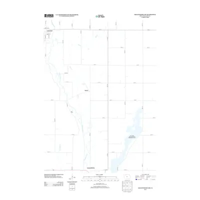
2013 Map of Graettinger East
USGS Topo · Published 2013About this map
Des Moines River meanders through the heart of Palo Alto County, defining the agricultural landscape between the northern edge of Emmetsburg and the town of Graettinger. This 2013 survey illustrates the highly organized section-line road network that serves the surrounding prairie, with small rural nodes like Osgood and Black Walnut situated along the river valley. The eastern portion of the map is dominated by the Five Island Lake State Game Management Area, a significant conservation tract that preserves the natural hydrology of the region's glacial lake systems. Human modifications to the landscape are evident in the precise path of Ditch Number 132 and the winding course of Jack Cr, showing the ongoing balance between the area's rich water resources and its intensive agricultural production.
Find a feature on this map
34 named features on this map. Tap any name to fly to it.
Don’t see what you’re looking for? This feature index may not catch every label — zoom into the map to look around manually.
Map Details
Editions of this 2013 Graettinger East Map
This is the sole edition of this map. No revisions or reprints were ever made.
Other maps of this area

1954 · Fairmont
USGS Topo · 1:250,000

1958 · Fairmont
USGS Topo · 1:250,000

1972 · Graettinger West
USGS Topo · 1:24,000

1972 · Wallingford
USGS Topo · 1:24,000

1972 · Ayrshire
USGS Topo · 1:24,000

1980 · Depew
USGS Topo · 1:24,000

1980 · Ringsted
USGS Topo · 1:24,000

1980 · Ingham Lake
USGS Topo · 1:24,000

1980 · Graettinger East
USGS Topo · 1:24,000
1980 · Emmetsburg
USGS Topo · 1:24,000