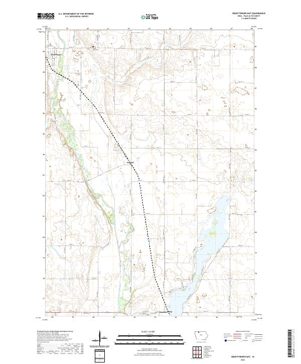
2022 Map of Graettinger East
USGS Topo · Published 2022About this map
The Des Moines River winds through a landscape defined by organized section lines and the agricultural heritage of Palo Alto County. This modern survey illustrates the settlement pattern between Graettinger in the northwest and the northern edge of Emmetsburg to the south. Small rural communities like Osgood are positioned along the county highway network, while the meandering course of Jack Cr and the engineered precision of Ditch Number 132 highlight the region's managed hydrography. Genealogy researchers may find interest in the location of Valley View Cem situated near the northern border, serving the surrounding township. The map effectively captures the transition from traditional river bottoms to the upland prairie, showing how modern development like Island View Ln has integrated into the natural geography.
Find a feature on this map
29 named features on this map. Tap any name to fly to it.
Don’t see what you’re looking for? This feature index may not catch every label — zoom into the map to look around manually.
Map Details
Editions of this 2022 Graettinger East Map
This is the sole edition of this map. No revisions or reprints were ever made.
Other maps of this area

1954 · Fairmont
USGS Topo · 1:250,000

1958 · Fairmont
USGS Topo · 1:250,000

1972 · Graettinger West
USGS Topo · 1:24,000

1972 · Wallingford
USGS Topo · 1:24,000

1972 · Ayrshire
USGS Topo · 1:24,000

1980 · Depew
USGS Topo · 1:24,000

1980 · Ringsted
USGS Topo · 1:24,000

1980 · Ingham Lake
USGS Topo · 1:24,000

1980 · Graettinger East
USGS Topo · 1:24,000
1980 · Emmetsburg
USGS Topo · 1:24,000