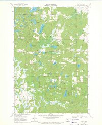
1970 Map of Graff
USGS Topo · Published 1972About this map
Graff sits within a dense network of glacial lakes and wetlands in Cass County, Minnesota, as recorded during this 1970 field check. The landscape is characterized by its numerous small water bodies, including Long Lake, Moose Lake, and the cluster of Seven Lakes. This map reveals a specific era of land management, where named features like Alem Meadow and Moose Lake Cem provide small pockets of human history amidst the woods and water. To the south, Meadow Brook and Home Brook drain the terrain, which is also crossed by the old Railroad grade and the Grade road. The intricate hydrography, including Mosquito Creek and Mayo Creek, illustrates the complex drainage patterns of the central Minnesota lake country before significant modern development altered the rural character of the region.
Find a feature on this map
35 named features on this map. Tap any name to fly to it.
Don’t see what you’re looking for? This feature index may not catch every label — zoom into the map to look around manually.
Map Details
Editions of this 1970 Graff Map
This is the sole edition of this map. No revisions or reprints were ever made.
Other maps of this area

1916 · Pillager
USGS Topo · 1:62,500

1919 · Pillager
USGS Topo · 1:62,500

1919 · Leader
USGS Topo · 1:62,500

1953 · Brainerd
USGS Topo · 1:250,000

1957 · Brainerd
USGS Topo · 1:250,000

1958 · Brainerd
USGS Topo · 1:250,000

1959 · Pine River
USGS Topo · 1:24,000

1959 · Pine River SW
USGS Topo · 1:24,000

1965 · Brainerd
USGS Topo · 1:250,000
1966 · Casino
USGS Topo · 1:24,000