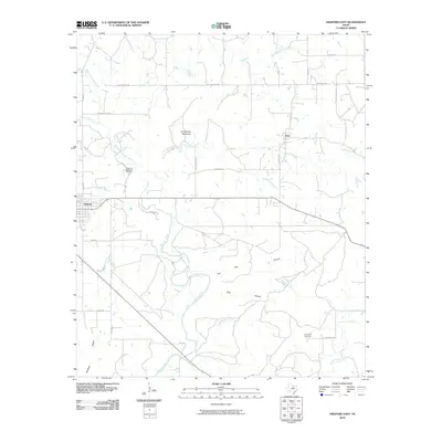
2010 Map of Graford East
USGS Topo · Published 2010About this map
Graford and the crossroads of Oran anchor this Palo Pinto County landscape, where the drainage of Keechi Creek and its many forks carve through the terrain. The topography is defined by significant elevations like Grindstone Mountain and several named landforms including Live Oak Canyon and Bear Hollow. This 2010 survey details a complex network of local roads such as Old Christian Rd and Keechi Ranch Rd, providing a clear view of the rural property divisions and access routes during this period.
Find a feature on this map
35 named features on this map. Tap any name to fly to it.
Don’t see what you’re looking for? This feature index may not catch every label — zoom into the map to look around manually.
Map Details
Editions of this 2010 Graford East Map
This is the sole edition of this map. No revisions or reprints were ever made.
Other maps of this area

1891 · Palo Pinto
USGS Topo · 1:125,000

1918 · Palo Pinto
USGS Topo · 1:125,000

1924 · Palo Pinto 2-a
USGS Topo · 1:48,000

1924 · Palo Pinto 1-b
USGS Topo · 1:48,000

1927 · Pickwick
USGS Topo · 1:62,500

1927 · Mineral Wells
USGS Topo · 1:62,500

1954 · Abilene
USGS Topo · 1:250,000

1954 · Wichita Falls
USGS Topo · 1:250,000

1958 · Wichita Falls
USGS Topo · 1:250,000

1958 · Abilene
USGS Topo · 1:250,000