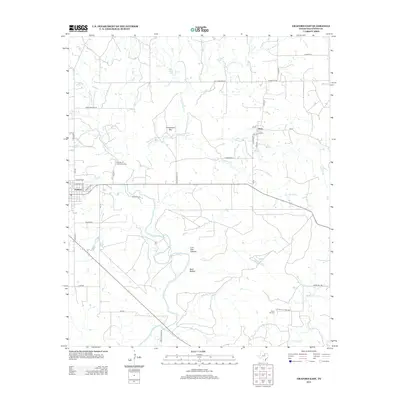
2012 Map of Graford East
USGS Topo · Published 2012About this map
Graford and the small community of Oran anchor this Palo Pinto County landscape, which is defined by a dense network of seasonal creek branches and rugged local relief. The terrain rises significantly at Grindstone Mtn north of the Graford townsite, while the southern reaches are marked by the deep cut of Live Oak Canyon and Bear Hollow. The area's hydrology is dominated by the sprawling forks of Keechi Creek, including E Fork Keechi Cr and W Fork Keechi Cr, which snake through the ranching and agricultural lands.
Find a feature on this map
43 named features on this map. Tap any name to fly to it.
Don’t see what you’re looking for? This feature index may not catch every label — zoom into the map to look around manually.
Map Details
Editions of this 2012 Graford East Map
This is the sole edition of this map. No revisions or reprints were ever made.
Other maps of this area

1891 · Palo Pinto
USGS Topo · 1:125,000

1918 · Palo Pinto
USGS Topo · 1:125,000

1924 · Palo Pinto 2-a
USGS Topo · 1:48,000

1924 · Palo Pinto 1-b
USGS Topo · 1:48,000

1927 · Pickwick
USGS Topo · 1:62,500

1927 · Mineral Wells
USGS Topo · 1:62,500

1954 · Abilene
USGS Topo · 1:250,000

1954 · Wichita Falls
USGS Topo · 1:250,000

1958 · Wichita Falls
USGS Topo · 1:250,000

1958 · Abilene
USGS Topo · 1:250,000