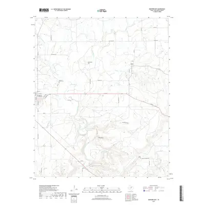
2019 Map of Graford East
USGS Topo · Published 2019About this map
The settlement of Graford anchors the western edge of this landscape, where residential streets like E Powell Ave and Wathen St meet the ranching roads of Palo Pinto County. Moving eastward, the terrain becomes increasingly defined by the deep incisions of the Keechi Creek drainage system and its numerous tributaries, including W Fork Keechi Cr and E Fork Keechi Cr. This area is characterized by dramatic elevation changes, with named landforms such as Grindstone Mtn and Bear Hollow providing landmarks for local geography. The small community of Oran sits at a crossroads to the northeast, while local heritage is preserved at the Garden of Memories Cem and Union Hill Cem. The map illustrates a contemporary pattern of rural Texas land use, where large ranch properties are accessed by a network of named lanes and crossings like High Lonesome Rd and Old Christian Rd.
Find a feature on this map
49 named features on this map. Tap any name to fly to it.
Don’t see what you’re looking for? This feature index may not catch every label — zoom into the map to look around manually.
Map Details
Editions of this 2019 Graford East Map
This is the sole edition of this map. No revisions or reprints were ever made.
Other maps of this area

1891 · Palo Pinto
USGS Topo · 1:125,000

1918 · Palo Pinto
USGS Topo · 1:125,000

1924 · Palo Pinto 2-a
USGS Topo · 1:48,000

1924 · Palo Pinto 1-b
USGS Topo · 1:48,000

1927 · Pickwick
USGS Topo · 1:62,500

1927 · Mineral Wells
USGS Topo · 1:62,500

1954 · Abilene
USGS Topo · 1:250,000

1954 · Wichita Falls
USGS Topo · 1:250,000

1958 · Wichita Falls
USGS Topo · 1:250,000

1958 · Abilene
USGS Topo · 1:250,000