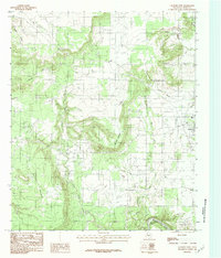
1984 Map of Graford West
USGS Topo · Published 1984About this map
Mc Clure Mountain dominates the central landscape of this West Texas survey, serving as a high point between the winding Dark Valley Creek to the west and Little Keechi Creek to the east. The terrain transitions from the high, open reaches of Rocky Prairie down to the southern boundary where the Brazos River carves a sharp turn at B C Harris Bend. In the late 1970s and early 1980s, the town of Graford anchors the eastern edge of the map, while smaller settlements like Vaughn and Flatrock appear near the northern drainage of Vaughn Branch. The map records a rural economy of creek-side homesteads and localized industry, evidenced by a Gravel Pit near the headwaters of Pecan Branch. Numerous small drainages like Ramsey Creek and Deep Elm Cr illustrate the complex watershed of Palo Pinto County.
Find a feature on this map
17 named features on this map. Tap any name to fly to it.
Don’t see what you’re looking for? This feature index may not catch every label — zoom into the map to look around manually.
Map Details
Editions of this 1984 Graford West Map
2 editions found
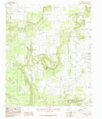
Other maps of this area

1891 · Palo Pinto
USGS Topo · 1:125,000

1918 · Palo Pinto
USGS Topo · 1:125,000

1924 · Palo Pinto 2-b
USGS Topo · 1:48,000

1924 · Palo Pinto 2-a
USGS Topo · 1:48,000

1924 · Palo Pinto 1-b
USGS Topo · 1:48,000

1924 · Palo Pinto 2-c
USGS Topo · 1:48,000

1927 · Pickwick
USGS Topo · 1:62,500

1927 · Mineral Wells
USGS Topo · 1:62,500

1954 · Abilene
USGS Topo · 1:250,000

1954 · Wichita Falls
USGS Topo · 1:250,000