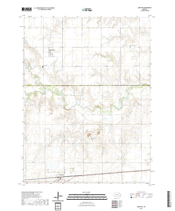
2021 Map of Grafton
USGS Topo · Published 2021About this map
Grafton and Lushton anchor this agricultural landscape on the York and Fillmore County border. The terrain is defined by the drainage of the West Fork Big Blue River and its tributaries, including Elk Run and Stone Cr. A structured grid of section roads like RD 1 and RD 8 organizes the prairie, while small-scale water management is visible at the Stuckey Reservoir. Genealogists will find the locations of local burial grounds, specifically Greenwood Cem and Lushton Cem, which serve as lasting markers of the area's rural communities. The layout of Grafton reveals a classic railroad-town orientation with streets such as Omaha ST and South ST running parallel to the southern corridor, contrasting with the north-south alignment of Randolph Ave.
Find a feature on this map
30 named features on this map. Tap any name to fly to it.
Don’t see what you’re looking for? This feature index may not catch every label — zoom into the map to look around manually.
Map Details
Editions of this 2021 Grafton Map
This is the sole edition of this map. No revisions or reprints were ever made.
Other maps of this area

1898 · York
USGS Topo · 1:125,000

1899 · York
USGS Topo · 1:125,000

1955 · Lincoln
USGS Topo · 1:250,000

1957 · Lincoln
USGS Topo · 1:250,000

1958 · Lincoln
USGS Topo · 1:250,000
1968 · Henderson
USGS Topo · 1:24,000

1969 · Bixby
USGS Topo · 1:24,000
1969 · Geneva
USGS Topo · 1:24,000

1969 · Fairmont
USGS Topo · 1:24,000
1969 · Grafton
USGS Topo · 1:24,000