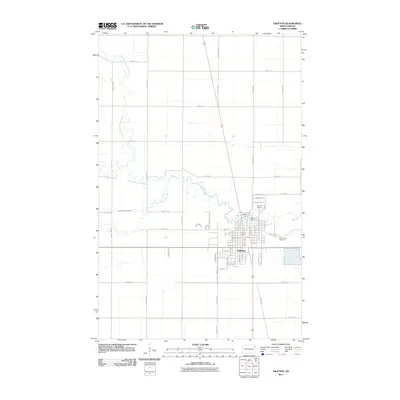
2011 Map of Grafton
USGS Topo · Published 2011About this map
Grafton stands at the convergence of three fluvial systems in the Red River Valley, where the North Branch Park River, Middle Branch Park River, and South Branch Park River combine to form the main stem of the Park River. This hydrological nexus defines the city's layout and historical development, with the Grafton Dam and Vigness Dam managing the flow of these prairie waterways. The town's grid is established east of the river forks, showing residential pockets like Westwood and the nearby Saint Johns Cemetery. Outside the city limits, the landscape transitions into the large-scale agricultural blocks typical of Walsh County, crisscrossed by a network of rural roads such as County Hwy-6 and 148th Ave NE, which reflect the precise section-line surveying of the region.
Find a feature on this map
58 named features on this map. Tap any name to fly to it.
Don’t see what you’re looking for? This feature index may not catch every label — zoom into the map to look around manually.
Map Details
Editions of this 2011 Grafton Map
This is the sole edition of this map. No revisions or reprints were ever made.
Other maps of this area

1939 · Glasston
USGS Topo · 1:62,500

1941 · Glasston
USGS Topo · 1:62,500

1943 · Grafton
USGS Topo · 1:62,500

1944 · Crystal
USGS Topo · 1:62,500

1952 · Thief River Falls
USGS Topo · 1:250,000

1956 · Thief River Falls
USGS Topo · 1:250,000

1957 · Thief River Falls
USGS Topo · 1:250,000

1960 · Grafton
USGS Topo · 1:24,000
1960 · Oakwood
USGS Topo · 1:24,000

1963 · Crystal SE
USGS Topo · 1:24,000