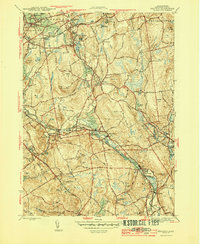
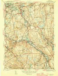
1944 Map of Grafton
USGS Topo · Published 1944About this map
Grafton and its surrounding mill villages define this mid-century landscape along the Blackstone River. The area is a dense network of industrial and institutional sites, including the expansive Grafton State Hospital and the early aviation hub at Grafton Airport. Settlement patterns follow the river valley through Saundersville, Fisherville, and Farnumsville, where numerous ponds like Fisherville Pond were harnessed for water power.
Find a feature on this map
78 named features on this map. Tap any name to fly to it.
Don’t see what you’re looking for? This feature index may not catch every label — zoom into the map to look around manually.
Map Details
Editions of this 1944 Grafton Map
5 editions found
Other maps of this area

1885 · Worcester
USGS Topo · 1:62,500

1886 · Worcester
USGS Topo · 1:62,500

1886 · Blackstone
USGS Topo · 1:62,500

1887 · Marlboro
USGS Topo · 1:62,500

1889 · Marlboro
USGS Topo · 1:62,500

1889 · Blackstone
USGS Topo · 1:62,500

1889 · Webster
USGS Topo · 1:62,500

1892 · Webster
USGS Topo · 1:62,500

1892 · Worcester
USGS Topo · 1:62,500

1893 · Blackstone
USGS Topo · 1:62,500