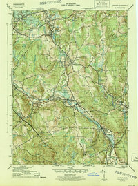
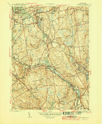
1944 Map of Grafton
USGS Topo · Published 1944About this map
Industrial villages and hilltop farms characterize this mid-century landscape along the Blackstone River. The river powers a series of connected mill settlements, from Saundersville and Fisherville down to Northbridge, where substantial infrastructure like Fisherville Pond and Rockdale Pond supported local manufacturing. Along the northern edge, the Grafton State Hospital occupies a sprawling campus near North Grafton, while the presence of the Grafton Airport and the Boston and Albany RR reflect the era's evolving transportation network.
Find a feature on this map
80 named features on this map. Tap any name to fly to it.
Don’t see what you’re looking for? This feature index may not catch every label — zoom into the map to look around manually.
Map Details
Editions of this 1944 Grafton Map
5 editions found
Other maps of this area

1885 · Worcester
USGS Topo · 1:62,500

1886 · Worcester
USGS Topo · 1:62,500

1886 · Blackstone
USGS Topo · 1:62,500

1887 · Marlboro
USGS Topo · 1:62,500

1889 · Marlboro
USGS Topo · 1:62,500

1889 · Blackstone
USGS Topo · 1:62,500

1889 · Webster
USGS Topo · 1:62,500

1892 · Webster
USGS Topo · 1:62,500

1892 · Worcester
USGS Topo · 1:62,500

1893 · Blackstone
USGS Topo · 1:62,500