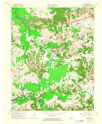
1963 Map of Graham
USGS Topo · Published 1964About this map
The winding Pond River defines the landscape of western Muhlenberg County during the early 1960s, serving as a natural boundary between several neighboring jurisdictions. The era marks a significant transition in local infrastructure, as the Western Kentucky Toll Road and Western Kentucky Parkway cut across the northern reaches, overlaying an older network of country roads. Small rural communities like Graham and McNary anchor the region, while the Illinois Central railroad follows the path of Illinois Creek toward Bakersport. For those researching local family history, several prominent landmarks are recorded, including Yeargins Chapel Cem, Vernal Grove Ch, and Mt Carmel Cem. The presence of numerous Oil Wells and active Strip Mines illustrates the industrial shift toward mineral extraction that characterized this part of the state in the mid-century.
Find a feature on this map
29 named features on this map. Tap any name to fly to it.
Don’t see what you’re looking for? This feature index may not catch every label — zoom into the map to look around manually.
Map Details
Editions of this 1963 Graham Map
2 editions found
Other maps of this area

1909 · Madisonville
USGS Topo · 1:62,500

1909 · Central City
USGS Topo · 1:62,500

1911 · Drakesboro
USGS Topo · 1:48,000

1912 · Nortonville
USGS Topo · 1:62,500

1913 · Drakesboro
USGS Topo · 1:62,500

1952 · Greenville
USGS Topo · 1:24,000

1952 · Crofton
USGS Topo · 1:24,000

1953 · Haleys Mill
USGS Topo · 1:24,000

1953 · Nortonville
USGS Topo · 1:24,000

1953 · Madisonville East
USGS Topo · 1:24,000