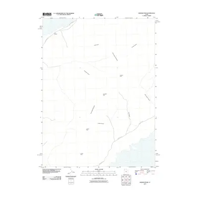
2010 Map of Graham Peak
USGS Topo · Published 2010About this map
The Silver Island Mountains dominate this 2010 U.S. Geological Survey representation of the Tooele County landscape. The topography is defined by a series of high summits, including Graham Peak, Campbell Peak, Jenkins Peak, and Lamus Peak, which overlook a network of drainage features. These dramatic rises are cut by numerous passages such as Donner Canyon, Campbell Canyon, and Cave Canyon, illustrating the complex erosional patterns of the range. Access to this remote mountain system is primary via Silver Island Rd, which skirts the base of the peaks and provides a path into the more isolated reaches of the terrain. The presence of Lost Canyon and Silver Island Canyon further emphasizes the intricate geological character of this Great Basin environment, where the relationship between the elevated desert peaks and the dry canyon floors is clearly delineated.
Find a feature on this map
12 named features on this map. Tap any name to fly to it.
Don’t see what you’re looking for? This feature index may not catch every label — zoom into the map to look around manually.
Map Details
Editions of this 2010 Graham Peak Map
This is the sole edition of this map. No revisions or reprints were ever made.
Other maps of this area

1953 · Tooele
USGS Topo · 1:250,000

1954 · Brigham City
USGS Topo · 1:250,000

1955 · Tooele
USGS Topo · 1:250,000

1958 · Brigham City
USGS Topo · 1:250,000

1962 · Brigham City
USGS Topo · 1:250,000
1967 · Crater Island SW
USGS Topo · 1:24,000

1970 · Crater Island
USGS Topo · 1:24,000

1971 · Silver Island Pass
USGS Topo · 1:24,000

1971 · Graham Peak
USGS Topo · 1:24,000

1971 · Tetzlaff Peak
USGS Topo · 1:24,000