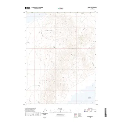
2023 Map of Graham Peak
USGS Topo · Published 2023About this map
The Silver Island Mountains dominate this landscape, rising sharply from the surrounding flats in northwestern Tooele County. This topography is defined by prominent summits such as Graham Peak and Campbell Peak, which are separated by a series of deep drainages including Donner Canyon and Lost Canyon. The eastern edge of the map transitions into the stark, expansive floor of the Great Salt Lake Desert, illustrating the isolation of this desert range.
Find a feature on this map
19 named features on this map. Tap any name to fly to it.
Don’t see what you’re looking for? This feature index may not catch every label — zoom into the map to look around manually.
Map Details
Editions of this 2023 Graham Peak Map
This is the sole edition of this map. No revisions or reprints were ever made.
Other maps of this area

1953 · Tooele
USGS Topo · 1:250,000

1954 · Brigham City
USGS Topo · 1:250,000

1955 · Tooele
USGS Topo · 1:250,000

1958 · Brigham City
USGS Topo · 1:250,000

1962 · Brigham City
USGS Topo · 1:250,000
1967 · Crater Island SW
USGS Topo · 1:24,000

1970 · Crater Island
USGS Topo · 1:24,000

1971 · Silver Island Pass
USGS Topo · 1:24,000

1971 · Graham Peak
USGS Topo · 1:24,000

1971 · Tetzlaff Peak
USGS Topo · 1:24,000