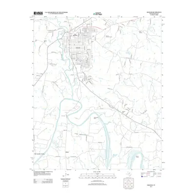
2012 Map of Graham
USGS Topo · Published 2012About this map
The city of Graham serves as the focal point of this 2012 survey, situated at the confluence of Salt Cr and the larger Brazos River. The street grid of the town is punctuated by local history landmarks such as Pioneer Cem and the Twin Mountains rising just to the north. South of the city, the landscape transitions into the distinctive winding hydrology of the Brazos, featuring sharp river meanders at Gooseneck Bend and Herron Bend.
Find a feature on this map
128 named features on this map. Tap any name to fly to it.
Don’t see what you’re looking for? This feature index may not catch every label — zoom into the map to look around manually.
Map Details
Editions of this 2012 Graham Map
This is the sole edition of this map. No revisions or reprints were ever made.
Other maps of this area

1890 · Breckenridge
USGS Topo · 1:125,000

1891 · Palo Pinto
USGS Topo · 1:125,000

1918 · Palo Pinto
USGS Topo · 1:125,000

1924 · Breckenridge 1-a
USGS Topo · 1:48,000

1924 · Palo Pinto 2-b
USGS Topo · 1:48,000

1924 · Graham 4-d
USGS Topo · 1:48,000

1925 · Graham 4-c
USGS Topo · 1:48,000

1925 · Breckenridge 1-b
USGS Topo · 1:48,000

1927 · Graham
USGS Topo · 1:62,500

1927 · Pickwick
USGS Topo · 1:62,500