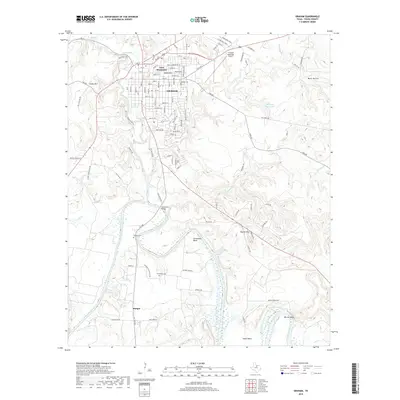
2019 Map of Graham
USGS Topo · Published 2019About this map
Graham serves as the focal point of this Young County landscape, situated where Salt Creek winds south toward its confluence with the Brazos River. The town's layout is defined by a dense grid of streets, including 7th St and South St, flanked by the prominent Twin Mountains to the north. This 2019 survey documents a region where agricultural land and river bottomlands meet established residential areas, featuring numerous family and community landmarks like Oak Grove Cem and Pioneer Cem. Further south, the terrain follows the dramatic meanders of the river at Gooseneck Bend, near the small settlement of Bunger. The importance of water management and local topography is evident in the presence of Manning Vick Lake 1 and the various crossings like Gooseneck Bridge, which link the rural southern reaches to the county seat.
Find a feature on this map
117 named features on this map. Tap any name to fly to it.
Don’t see what you’re looking for? This feature index may not catch every label — zoom into the map to look around manually.
Map Details
Editions of this 2019 Graham Map
This is the sole edition of this map. No revisions or reprints were ever made.
Other maps of this area

1890 · Breckenridge
USGS Topo · 1:125,000

1891 · Palo Pinto
USGS Topo · 1:125,000

1918 · Palo Pinto
USGS Topo · 1:125,000

1924 · Breckenridge 1-a
USGS Topo · 1:48,000

1924 · Palo Pinto 2-b
USGS Topo · 1:48,000

1924 · Graham 4-d
USGS Topo · 1:48,000

1925 · Graham 4-c
USGS Topo · 1:48,000

1925 · Breckenridge 1-b
USGS Topo · 1:48,000

1927 · Graham
USGS Topo · 1:62,500

1927 · Pickwick
USGS Topo · 1:62,500