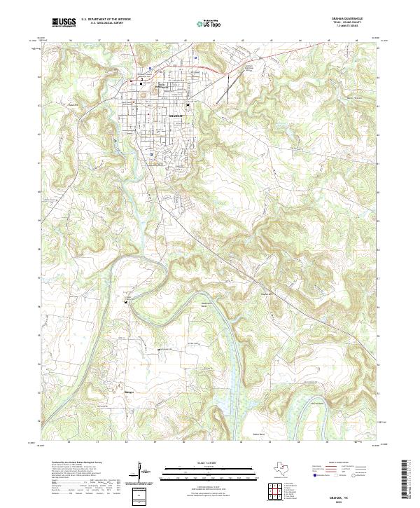
2022 Map of Graham
USGS Topo · Published 2022About this map
The Young County Courthouse serves as the focal point of Graham, Texas, where a grid of urban streets meets the meandering waters of Salt Creek. To the south, the landscape shifts into the dramatic horseshoe turns of the Brazos River, defined by prominent river features such as Gooseneck Bend, Salem Bend, and Herron Bend. This area shows a distinct transition from the concentrated settlement of the county seat to the outlying community of Bunger and the scattered family farmsteads along the river valley.
Find a feature on this map
124 named features on this map. Tap any name to fly to it.
Don’t see what you’re looking for? This feature index may not catch every label — zoom into the map to look around manually.
Map Details
Editions of this 2022 Graham Map
This is the sole edition of this map. No revisions or reprints were ever made.
Other maps of this area

1890 · Breckenridge
USGS Topo · 1:125,000

1891 · Palo Pinto
USGS Topo · 1:125,000

1918 · Palo Pinto
USGS Topo · 1:125,000

1924 · Breckenridge 1-a
USGS Topo · 1:48,000

1924 · Palo Pinto 2-b
USGS Topo · 1:48,000

1924 · Graham 4-d
USGS Topo · 1:48,000

1925 · Graham 4-c
USGS Topo · 1:48,000

1925 · Breckenridge 1-b
USGS Topo · 1:48,000

1927 · Graham
USGS Topo · 1:62,500

1927 · Pickwick
USGS Topo · 1:62,500