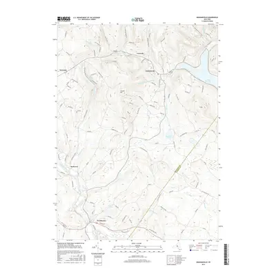
2016 Map of Grahamsville
USGS Topo · Published 2016About this map
Grahamsville and Woodbourne anchor this portion of the Catskills, where the landscape is defined by massive water management infrastructure and steep terrain. The Rondout Reservoir dominates the eastern edge, supported by the subterranean Neversink Rondout Aqueduct which tunnels through the earth south of Thunder Hill. These mid-century engineering projects transformed the region's hydrography, connecting the Neversink River and Chestnut Cr to the broader New York City water supply system.
Find a feature on this map
104 named features on this map. Tap any name to fly to it.
Don’t see what you’re looking for? This feature index may not catch every label — zoom into the map to look around manually.
Map Details
Editions of this 2016 Grahamsville Map
This is the sole edition of this map. No revisions or reprints were ever made.
Other maps of this area

1903 · Slide Mountain
USGS Topo · 1:62,500

1904 · Ellenville
USGS Topo · 1:62,500

1905 · Slide Mountain
USGS Topo · 1:62,500

1906 · Ellenville
USGS Topo · 1:62,500

1909 · Monticello
USGS Topo · 1:62,500

1910 · Neversink
USGS Topo · 1:62,500

1911 · Monticello
USGS Topo · 1:62,500

1942 · Neversink
USGS Topo · 1:62,500

1942 · Lackawack
USGS Topo · 1:24,000
1942 · Ellenville
USGS Topo · 1:24,000