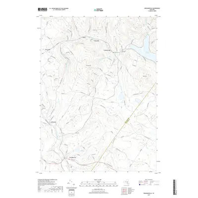
2019 Map of Grahamsville
USGS Topo · Published 2019About this map
Grahamsville and the eastern reaches of the Rondout Reservoir anchor this 2019 survey of the Catskill region at the Sullivan Co and Ulster Co border. The landscape is defined by the critical infrastructure of the New York City water supply system, most notably the subterranean path of the Neversink-Rondout Aqueduct which traverses beneath Thunder Hill. Along the southern edge, the Neversink River flows toward Woodbourne, while the village of Hasbrouck sits near the confluence of Wynkoop Brook. The map reveals a mix of dense forest and valley settlements, where older landmarks like the Grahamsville Rural Cem persist alongside the small hamlets of Curry and Unionville north of Chestnut Creek. This topography illustrates the enduring relationship between the Catskill terrain and the engineered waterways that have reshaped local geography since the mid-20th century.
Find a feature on this map
108 named features on this map. Tap any name to fly to it.
Don’t see what you’re looking for? This feature index may not catch every label — zoom into the map to look around manually.
Map Details
Editions of this 2019 Grahamsville Map
This is the sole edition of this map. No revisions or reprints were ever made.
Other maps of this area

1903 · Slide Mountain
USGS Topo · 1:62,500

1904 · Ellenville
USGS Topo · 1:62,500

1905 · Slide Mountain
USGS Topo · 1:62,500

1906 · Ellenville
USGS Topo · 1:62,500

1909 · Monticello
USGS Topo · 1:62,500

1910 · Neversink
USGS Topo · 1:62,500

1911 · Monticello
USGS Topo · 1:62,500

1942 · Neversink
USGS Topo · 1:62,500

1942 · Lackawack
USGS Topo · 1:24,000
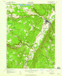
1942 · Ellenville
USGS Topo · 1:24,000