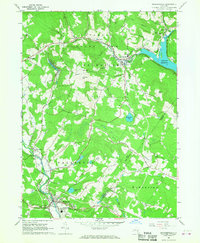
1966 Map of Grahamsville
USGS Topo · Published 1968About this map
Rondout Reservoir and the Neversink River dominate this mid-1960s landscape, illustrating the critical role of the Sullivan County watershed in regional water management. The infrastructure of the Rondout Aqueduct and West Delaware Aqueduct is clearly traced, connecting these rural uplands to distant urban centers. In the southern reach, the Woodbourne Correctional Institute stands as a prominent local landmark near the village of Woodbourne.
Find a feature on this map
44 named features on this map. Tap any name to fly to it.
Don’t see what you’re looking for? This feature index may not catch every label — zoom into the map to look around manually.
Map Details
Editions of this 1966 Grahamsville Map
This is the sole edition of this map. No revisions or reprints were ever made.
Other maps of this area

1903 · Slide Mountain
USGS Topo · 1:62,500

1904 · Ellenville
USGS Topo · 1:62,500

1905 · Slide Mountain
USGS Topo · 1:62,500

1906 · Ellenville
USGS Topo · 1:62,500

1909 · Monticello
USGS Topo · 1:62,500

1910 · Neversink
USGS Topo · 1:62,500

1911 · Monticello
USGS Topo · 1:62,500

1942 · Neversink
USGS Topo · 1:62,500

1942 · Lackawack
USGS Topo · 1:24,000
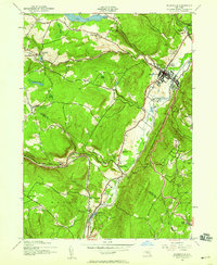
1942 · Ellenville
USGS Topo · 1:24,000