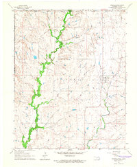
1964 Map of Grainola
USGS Topo · Published 1966About this map
The Grainola and Frankfort communities anchor this mid-1960s survey of the northern Oklahoma borderlands, situated within the Foraker Indian Reservation. This landscape is defined by the Midland Valley and a dense network of watercourses, including the winding Beaver Creek and Salt Creek. The presence of the Frankfort Oil Field in the northern portion of the map indicates the regional importance of the petroleum industry during this era.
Find a feature on this map
14 named features on this map. Tap any name to fly to it.
Don’t see what you’re looking for? This feature index may not catch every label — zoom into the map to look around manually.
Map Details
Editions of this 1964 Grainola Map
2 editions found
Other maps of this area

1889 · Burden
USGS Topo · 1:125,000

1916 · Foraker
USGS Topo · 1:62,500

1935 · Kaw
USGS Topo · 1:62,500

1955 · Wichita
USGS Topo · 1:250,000

1955 · Enid
USGS Topo · 1:250,000

1958 · Enid
USGS Topo · 1:250,000

1958 · Wichita
USGS Topo · 1:250,000
1962 · Cedar Vale West
USGS Topo · 1:24,000

1962 · Dexter SW
USGS Topo · 1:24,000

1964 · Kaw City
USGS Topo · 1:24,000