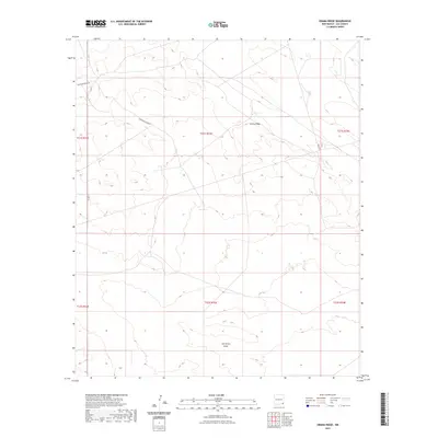
2023 Map of Grama Ridge
USGS Topo · Published 2023About this map
Grama Ridge rises above the southeastern New Mexico landscape, anchoring a quadrangle defined by high desert terrain and industrial transit. This portion of Lea County is characterized by the expansive depression of the San Simon Swale, which dominates the southern half of the map. Modern transport routes, including Delaware Basin Rd and Berry Rd, cut across the public land survey system grid, reflecting the region's importance for resource extraction and land management. The township and range boundaries, such as those for t21s r33e, provide a framework for the vast, open acreage that defines this section of the state near the Texas border.
Find a feature on this map
11 named features on this map. Tap any name to fly to it.
Don’t see what you’re looking for? This feature index may not catch every label — zoom into the map to look around manually.
Map Details
Editions of this 2023 Grama Ridge Map
This is the sole edition of this map. No revisions or reprints were ever made.
Other maps of this area

1954 · Hobbs
USGS Topo · 1:250,000

1958 · Hobbs
USGS Topo · 1:250,000

1963 · Oil Center
USGS Topo · 1:62,500

1963 · Monument
USGS Topo · 1:62,500

1963 · Laguna Gatuna
USGS Topo · 1:62,500

1963 · Hat Mesa
USGS Topo · 1:62,500

1978 · Jal
USGS Topo · 1:100,000

1984 · Lea
USGS Topo · 1:24,000
1984 · Tip Top Wells
USGS Topo · 1:24,000
1984 · Grama Ridge
USGS Topo · 1:24,000