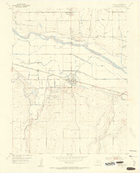
1953 Map of Granada
USGS Topo · Published 1954About this map
Camp Amache (Aban'd) sits south of the Arkansas River in this 1950s survey, marking a site of significant mid-century history. The town of Granada serves as a central hub, flanked by the Atchison Topeka and Santa Fe railroad and the Old Santa Fe Trail. The landscape is defined by an intricate network of irrigation, including the North Granada Ditch, South Granada Ditch, and Buffalo Canal, which support agriculture in the Arkansas Valley. Genealogy interests are well-served by the presence of Sunnyslope Cem near Bristol and the Granada Cem. A Historical Marker and remnants of the Lamar Canal (Aband) provide physical evidence of the evolving land use and transportation corridors that shaped Prowers County during this era.
Find a feature on this map
26 named features on this map. Tap any name to fly to it.
Don’t see what you’re looking for? This feature index may not catch every label — zoom into the map to look around manually.
Map Details
Editions of this 1953 Granada Map
3 editions found
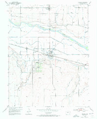
Other maps of this area

1890 · Granada
USGS Topo · 1:125,000

1891 · Albany
USGS Topo · 1:125,000

1892 · Granada
USGS Topo · 1:125,000

1893 · Albany
USGS Topo · 1:125,000

1894 · Granada
USGS Topo · 1:125,000

1952 · Carlton
USGS Topo · 1:24,000

1953 · Holly West
USGS Topo · 1:24,000

1953 · Granada
USGS Topo · 1:24,000

1954 · Lamar
USGS Topo · 1:250,000

1955 · Granada NW
USGS Topo · 1:24,000