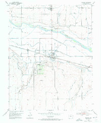
1953 Map of Granada
USGS Topo · Published 1974About this map
Camp Amache (Aban'd) sits south of the Arkansas River in Prowers County, its former footprint marked by a grid of streets, a Water Tank, and the Amache Cem. This site, along with the nearby town of Granada, is surrounded by an extensive network of irrigation infrastructure critical to the high plains economy, including the North Granada Ditch, South Granada Ditch, and X-Y Canal. The Atchison Topeka and Santa Fe railroad bisects the landscape, connecting the local agricultural centers of Bristol and Warwick. North of the river, Wolf Creek and Buffalo Creek cut through the terrain, while the area's social history is reflected in the placement of Sunnyslope Cem and Granada Cem. This mid-century survey documents a transition from wartime use to sustained ranching and farming operations in eastern Colorado.
Find a feature on this map
26 named features on this map. Tap any name to fly to it.
Don’t see what you’re looking for? This feature index may not catch every label — zoom into the map to look around manually.
Map Details
Editions of this 1953 Granada Map
3 editions found
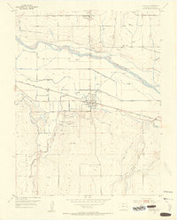
Other maps of this area

1890 · Granada
USGS Topo · 1:125,000

1891 · Albany
USGS Topo · 1:125,000

1892 · Granada
USGS Topo · 1:125,000

1893 · Albany
USGS Topo · 1:125,000

1894 · Granada
USGS Topo · 1:125,000

1952 · Carlton
USGS Topo · 1:24,000

1953 · Holly West
USGS Topo · 1:24,000

1953 · Granada
USGS Topo · 1:24,000

1954 · Lamar
USGS Topo · 1:250,000

1955 · Granada NW
USGS Topo · 1:24,000