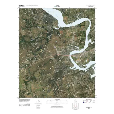
2010 Map of Granbury
USGS Topo · Published 2010About this map
Lake Granbury snakes through the center of this Hood County landscape, defining the character of a region where modern lakeside development meets established Texas history. The Hood County Courthouse Historic District anchors the town of Granbury, surrounded by a network of suburban expansion and older settlements like Thorp Spring and Brushy. High points such as Thompson Mountain, Indian Mountain, and the prominent Comanche Peak provide natural overlooks above the winding Brazos River valley. The infrastructure of the era is evident in the Granbury Municipal Airport and multiple water control structures including the Bowser Lake Dam. For those tracing local families, several established burial grounds including Granbury Cemetery, Thorp Spring Cemetery, and Brushy Cemetery are clearly documented alongside rural roads like Lipan Hwy and Paluxy Hwy.
Find a feature on this map
78 named features on this map. Tap any name to fly to it.
Don’t see what you’re looking for? This feature index may not catch every label — zoom into the map to look around manually.
Map Details
Editions of this 2010 Granbury Map
This is the sole edition of this map. No revisions or reprints were ever made.
Other maps of this area

1889 · Granbury
USGS Topo · 1:125,000

1891 · Weatherford
USGS Topo · 1:125,000

1893 · Weatherford
USGS Topo · 1:125,000

1923 · Granbury 2-a
USGS Topo · 1:48,000

1923 · Granbury 1-b
USGS Topo · 1:48,000

1924 · Weatherford 3-d
USGS Topo · 1:48,000

1924 · Granbury 1-c
USGS Topo · 1:48,000

1928 · Godley
USGS Topo · 1:62,500

1931 · Dennis
USGS Topo · 1:62,500

1931 · Tolar
USGS Topo · 1:62,500