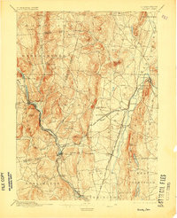
1892 Map of Granby
USGS Topo · Published 1905About this map
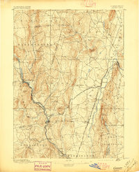
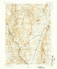
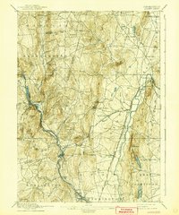
The Farmington River carves a central path through this late-nineteenth-century landscape, driving the industrial development of manufacturing centers like Collinsville and Unionville. In the west, the river passes through the dramatic gap known as Satans Kingdom, while the eastern portion of the sheet is defined by the sharp ridge of Talcott Mountain, where Bartlett Tower and Heublein Tower stand as prominent landmarks. This era shows a complex rail network essential to the region's economy, including the Central New England and Western Railroad crossing the valley. The map documents numerous smaller farming hamlets and stations such as Hoskins, Pine Meadow, and Granby Station before twentieth-century suburbanization altered the character of these Hartford County towns. Distinctive terrain features like the Barnndoor Hills and Whortleberry Hill provide a clear view of the natural barriers that shaped the early road and rail corridors.
Find a feature on this map
69 named features on this map. Tap any name to fly to it.
Don’t see what you’re looking for? This feature index may not catch every label — zoom into the map to look around manually.
Map Details
Editions of this 1892 Granby Map
8 editions found

Other maps of this area

1886 · Springfield
USGS Topo · 1:62,500

1887 · Granville
USGS Topo · 1:62,500

1888 · Sandisfield
USGS Topo · 1:62,500

1889 · Springfield
USGS Topo · 1:62,500

1889 · Granville
USGS Topo · 1:62,500

1892 · Winsted
USGS Topo · 1:62,500

1892 · Hartford
USGS Topo · 1:62,500

1892 · Meriden
USGS Topo · 1:62,500

1892 · Granby
USGS Topo · 1:62,500

1893 · Springfield
USGS Topo · 1:62,500