
1953 Map of Grand Canyon
USGS Topo · Published 1967About this map
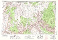
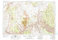
The Colorado River carves a massive course across this mid-century landscape, defining the boundaries of the Kaibab Plateau and the Shivwits Plateau. The map illustrates a complex network of geological features and early infrastructure, including the terminus of the Atchison Topeka and Santa Fe Ry at the settlement of Grand Canyon. Tribal lands are prominent, with the Kaibab Indian Reservation in the north near Fredonia and the Hualpai Indian Reservation south of the river. Beyond the major canyons, the map details the arid basins of Bulrush Wash and the remote peaks of the Virgin Mountains in the west. This 1950s data, revised in the late 1960s, documents the region before modern mass-tourism development, highlighting isolated outposts like Hermits Rest and Cane Beds.
Find a feature on this map
99 named features on this map. Tap any name to fly to it.
Don’t see what you’re looking for? This feature index may not catch every label — zoom into the map to look around manually.
Map Details
Editions of this 1953 Grand Canyon Map
3 editions found
Other maps of this area

1885 · St. George
USGS Topo · 1:250,000

1885 · Pioche
USGS Topo · 1:250,000

1886 · Diamond Creek
USGS Topo · 1:250,000

1886 · Camp Mohave
USGS Topo · 1:250,000

1886 · Kanab
USGS Topo · 1:250,000

1886 · Escalante
USGS Topo · 1:250,000

1886 · Saint Thomas
USGS Topo · 1:250,000

1886 · San Francisco Mtns
USGS Topo · 1:250,000

1886 · Mt. Trumbull
USGS Topo · 1:250,000

1886 · Chino
USGS Topo · 1:250,000