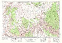
1953 Map of Grand Canyon
USGS Topo · Published 1973About this map
Grand Canyon geography dominates this mid-century survey, which documents the vast drainage systems and dramatic geological formations of Northern Arizona before the era of intensive modern development. The map details the intricate descent from the Kaibab Plateau into the Granite Gorge, following the course of the Colorado River as it meets tributaries like Bright Angel Creek and Kanab Creek. Beyond the river itself, the sheet provides a clear look at the spatial relationship between indigenous lands, including the Havasupai Indian Reservation and Hualapai Indian Reservation, and federal designations such as Grand Canyon National Park. Remote settlements like Moccasin and Fredonia appear near the Utah border, while the western reach shows the early footprint of the Lake Mead National Recreation Area. Significant vertical landmarks, from the Shinarump Cliffs to the Virgin Mountains, define the horizon of this high-desert landscape.
Find a feature on this map
39 named features on this map. Tap any name to fly to it.
Don’t see what you’re looking for? This feature index may not catch every label — zoom into the map to look around manually.
Map Details
Editions of this 1953 Grand Canyon Map
3 editions found

Other maps of this area

1885 · St. George
USGS Topo · 1:250,000

1885 · Pioche
USGS Topo · 1:250,000

1886 · Diamond Creek
USGS Topo · 1:250,000

1886 · Camp Mohave
USGS Topo · 1:250,000

1886 · Kanab
USGS Topo · 1:250,000

1886 · Escalante
USGS Topo · 1:250,000

1886 · Saint Thomas
USGS Topo · 1:250,000

1886 · San Francisco Mtns
USGS Topo · 1:250,000

1886 · Mt. Trumbull
USGS Topo · 1:250,000

1886 · Chino
USGS Topo · 1:250,000