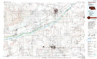
1985 Map of Grand Island
USGS Topo · Published 1994About this map
Grand Island and Hastings anchor this mid-1980s topographical survey of central Nebraska, a landscape defined by the expansive multi-channeled Platte River. The map meticulously details the braided river system, including named landforms like Mormon Island and Shoemaker Island, which sits between the river's north and middle channels. Transport and industry are evident through the paths of the Union Pacific and Burlington Northern railroads, which parallel the river and connect smaller agricultural hubs like Shelton and Gibbon. Genealogical and local history value is found in features like Parkview Cem in Hastings and Fonner Park in Grand Island. The map also traces the Old Military Reservation Boundary and identifies specialized land use such as the Army National Guard Training Site and the Central Community College campus, reflecting the region's educational and institutional growth.
Find a feature on this map
140 named features on this map. Tap any name to fly to it.
Don’t see what you’re looking for? This feature index may not catch every label — zoom into the map to look around manually.
Map Details
Editions of this 1985 Grand Island Map
2 editions found
Other maps of this area

1892 · Grand Island
USGS Topo · 1:62,500

1894 · Kenesaw
USGS Topo · 1:62,500

1894 · Kearney
USGS Topo · 1:62,500

1894 · Minden
USGS Topo · 1:62,500

1895 · Grand Island
USGS Topo · 1:62,500

1895 · Wood River
USGS Topo · 1:62,500

1896 · Holdrege
USGS Topo · 1:125,000

1896 · Kearney
USGS Topo · 1:125,000

1896 · Wood River
USGS Topo · 1:125,000

1896 · Stromsburg
USGS Topo · 1:125,000