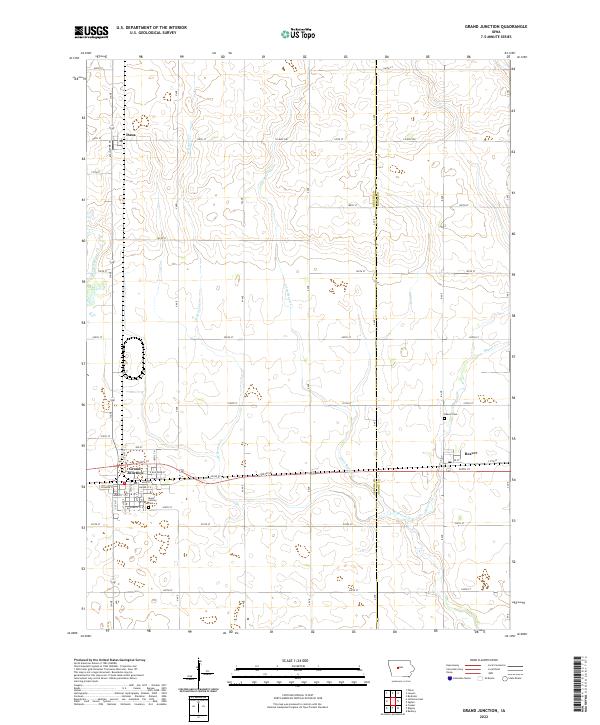
2022 Map of Grand Junction
USGS Topo · Published 2022About this map
Grand Junction serves as the primary hub of this Iowa landscape, where a dense grid of residential streets including W Hager St and Elizabeth St E centers on the corridor of E Railroad St. The town is flanked by historic burial sites like Mount Calvary Cem, while the surrounding agricultural plains are defined by the winding paths of W Beaver Cr and Little Beaver Cr. To the north, the small settlement of Dana sits along the Greene Co line, and to the east, the village of Beaver marks the boundary into Boone Co. The map reveals a highly structured rural environment where section lines dictate the placement of local roads such as 160th St and Co Hwy P46, reflecting the enduring township-and-range surveying system of the American Midwest.
Find a feature on this map
42 named features on this map. Tap any name to fly to it.
Don’t see what you’re looking for? This feature index may not catch every label — zoom into the map to look around manually.
Map Details
Editions of this 2022 Grand Junction Map
This is the sole edition of this map. No revisions or reprints were ever made.
Other maps of this area

1950 · Perry
USGS Topo · 1:62,500

1951 · Perry
USGS Topo · 1:62,500

1951 · Ogden
USGS Topo · 1:62,500

1954 · Bagley
USGS Topo · 1:62,500

1954 · Omaha
USGS Topo · 1:250,000

1954 · Fort Dodge
USGS Topo · 1:250,000

1957 · Omaha
USGS Topo · 1:250,000

1957 · Fort Dodge
USGS Topo · 1:250,000

1958 · Omaha
USGS Topo · 1:250,000

1958 · Fort Dodge
USGS Topo · 1:250,000