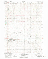
1982 Map of Grand Junction
USGS Topo · Published 1983About this map
Grand Junction serves as the primary hub of this early 1980s Iowa landscape, where the Chicago and North Western railroad corridor defines the town's orientation and industrial layout. The surrounding terrain is meticulously surveyed, showing the intricate drainage patterns of E Butterick Creek, West Beaver Creek, and Little Beaver Creek. Agricultural and local history is anchored by smaller settlements such as Dana to the north and Beaver to the east, the latter sitting just across the county line. Cultural landmarks including Mount Calvary Cem and Beaver Cem provide specific points for genealogical research. The map also documents modern utility infrastructure of the era, such as the Sewage Treatment Plant and a prominent Radio Tower, reflecting the local municipal and communications network at the start of the 1980s.
Find a feature on this map
19 named features on this map. Tap any name to fly to it.
Don’t see what you’re looking for? This feature index may not catch every label — zoom into the map to look around manually.
Map Details
Editions of this 1982 Grand Junction Map
This is the sole edition of this map. No revisions or reprints were ever made.
Other maps of this area

1950 · Perry
USGS Topo · 1:62,500

1951 · Perry
USGS Topo · 1:62,500

1951 · Ogden
USGS Topo · 1:62,500

1954 · Bagley
USGS Topo · 1:62,500

1954 · Omaha
USGS Topo · 1:250,000

1954 · Fort Dodge
USGS Topo · 1:250,000

1957 · Omaha
USGS Topo · 1:250,000

1957 · Fort Dodge
USGS Topo · 1:250,000

1958 · Omaha
USGS Topo · 1:250,000

1958 · Fort Dodge
USGS Topo · 1:250,000