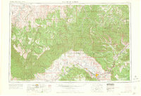
1965 Map of Grand Junction
USGS Topo · Published 1965About this map
Grand Junction serves as the regional hub at the confluence of the Colorado River and the Gunnison, anchoring a valley of irrigated orchards and small towns like Palisade and Fruita. To the west and north, the landscape transforms into a high-desert plateau defined by the towering Book Cliffs and Roan Cliffs, which segment the terrain into distinct basins like the Uintah Basin. This 1960s-era documentation shows the vital agricultural infrastructure of the Grand Valley, including the Government Highline Canal, alongside the industrial and geological assets of the region.
Find a feature on this map
138 named features on this map. Tap any name to fly to it.
Don’t see what you’re looking for? This feature index may not catch every label — zoom into the map to look around manually.
Map Details
Editions of this 1965 Grand Junction Map
2 editions found

Other maps of this area

1885 · San Rafael
USGS Topo · 1:250,000

1885 · East Tavaputs
USGS Topo · 1:250,000

1885 · La Sal
USGS Topo · 1:250,000

1885 · Ashley
USGS Topo · 1:250,000

1885 · Uinta
USGS Topo · 1:250,000

1886 · Price River
USGS Topo · 1:250,000

1896 · Price River
USGS Topo · 1:250,000

1906 · Grand Hogback
USGS Topo · 1:125,000

1907 · Rangely
USGS Topo · 1:125,000

1907 · Jensen
USGS Topo · 1:125,000