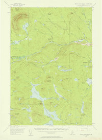
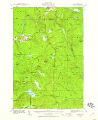
1954 Map of Grand Lake Seboeis
USGS Topo · Published 1958About this map
Grand Lake Seboeis dominates the southern landscape of this mid-century survey, its narrow waters stretching between Jameson Ridge and Flying Hill. This wilderness area at the border of Aroostook and Penobscot counties is defined by a dense network of sporting and logging outposts, including Hart Camp, Junkins Camp, and Chase Camp. The northern reaches are bisected by the Aroostook River, which winds past Salmon Pool and Gilman Beach before reaching the settlement of Oxbow.
Find a feature on this map
99 named features on this map. Tap any name to fly to it.
Don’t see what you’re looking for? This feature index may not catch every label — zoom into the map to look around manually.
Map Details
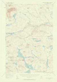
Editions of this 1954 Grand Lake Seboeis Map
3 editions found

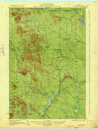
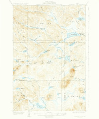
Other maps of this area

1930 · Greenlaw
USGS Topo · 1:48,000

1931 · Ashland
USGS Topo · 1:48,000

1931 · Mooseleuk Lake
USGS Topo · 1:48,000
1933 · Greenlaw
USGS Topo · 1:62,500

1934 · Ashland
USGS Topo · 1:62,500
1935 · Mooseleuk Lake
USGS Topo · 1:62,500

1940 · Island Falls
USGS Topo · 1:62,500
1940 · Oxbow
USGS Topo · 1:62,500
1942 · Island Falls
USGS Topo · 1:62,500
1942 · Oxbow
USGS Topo · 1:62,500