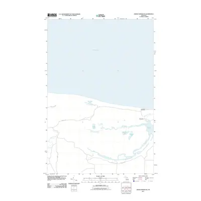
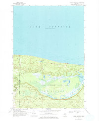
2011 Map of Grand Marais NE
USGS Topo · Published 2011About this map
Lake Superior dominates the northern reaches of this coastal Michigan landscape, where the shoreline meets a complex network of inland hydrology. The terrain is defined by the winding paths of the Dead Sucker River and the Blind Sucker River, which together create a mosaic of wetlands and small water bodies including Brucker Lake and Keopfgen Lake. This 2011 survey shows how the land is accessed primarily through secondary routes like County Rd-407 and Holland Lake Rd. Recreational sites such as the Lake Superior Campground and Blind Sucker Campground highlight the area's importance for public access to the Great Lakes and the river systems. The inclusion of smaller features like Randolph Lake and Props Lake provides a detailed view of the local drainage patterns typical of Luce County’s northern edge.
Find a feature on this map
15 named features on this map. Tap any name to fly to it.
Don’t see what you’re looking for? This feature index may not catch every label — zoom into the map to look around manually.
Map Details
Editions of this 2011 Grand Marais NE Map
This is the sole edition of this map. No revisions or reprints were ever made.
Other maps of this area

1954 · Sault Sainte Marie
USGS Topo · 1:250,000

1956 · Sault Sainte Marie
USGS Topo · 1:250,000

1957 · Sault Sainte Marie
USGS Topo · 1:250,000

1958 · Sault Sainte Marie
USGS Topo · 1:250,000
1968 · Nawakwa Lake
USGS Topo · 1:24,000

1968 · Muskallonge Lake SW
USGS Topo · 1:24,000

1968 · Muskallonge Lake West
USGS Topo · 1:24,000
1968 · Grand Marais SE
USGS Topo · 1:24,000
1968 · Grand Marais
USGS Topo · 1:24,000
1968 · Grand Marais NE
USGS Topo · 1:24,000