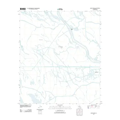
2012 Map of Grand River
USGS Topo · Published 2012About this map
The Grand River and the complex hydraulics of Iberville Parish define this landscape, where natural waterways and industrial infrastructure overlap. The course of the Upper Grand River and Bayou Maringouin dominate the northern terrain, leading toward the Atchafalaya Basin Levee Rd which serves as a critical boundary for the region's flood control. The map illustrates a high density of named water features, including the aptly named Graveyard Bayou, Bloody Bayou, and Sawyers Cove, reflecting the historical human presence and the local nomenclature of the Louisiana wetlands.
Find a feature on this map
23 named features on this map. Tap any name to fly to it.
Don’t see what you’re looking for? This feature index may not catch every label — zoom into the map to look around manually.
Map Details
Editions of this 2012 Grand River Map
This is the sole edition of this map. No revisions or reprints were ever made.
Other maps of this area

1935 · Osca Bayou
USGS Topo · 1:62,500

1935 · Chicot Lake
USGS Topo · 1:62,500

1940 · Grosse Tete
USGS Topo · 1:62,500

1941 · Loreauville
USGS Topo · 1:62,500

1953 · Crescent
USGS Topo · 1:24,000

1953 · Cow Bayou
USGS Topo · 1:24,000

1953 · Pigeon Bay
USGS Topo · 1:24,000

1953 · Addis
USGS Topo · 1:24,000

1953 · Grosse Tete SW
USGS Topo · 1:24,000

1954 · Chicot Lake
USGS Topo · 1:62,500