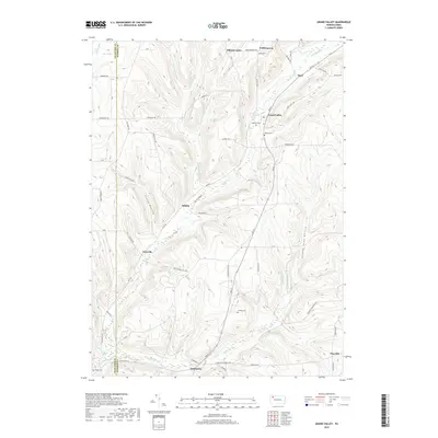
2019 Map of Grand Valley
USGS Topo · Published 2019About this map
Grand Valley and the surrounding townships of Warren County are defined by a network of creeks and small settlements in this 2019 survey. The area's geography is shaped by the winding Caldwell Cr and its many tributaries, including W Br Caldwell Cr and Middle Br W Br Caldwell Cr. For genealogists, the map identifies several distinct burial grounds such as Naulby Cem, Loomis Cem, and Cheney Cem, providing precise locations for family history research. Small hamlets like Selkirk, Enterprise, and Eldred Center are linked by a dense grid of rural routes including Rte 27 and Tidioute Enterprise Rd. The terrain is marked by prominent rises such as Chappel Hill and Emerson Hill, while the Blue Swamp and Shirley Run occupy the northwestern corner near the Crawford County line, illustrating the varied hydrology of the region.
Find a feature on this map
64 named features on this map. Tap any name to fly to it.
Don’t see what you’re looking for? This feature index may not catch every label — zoom into the map to look around manually.
Map Details
Editions of this 2019 Grand Valley Map
This is the sole edition of this map. No revisions or reprints were ever made.
Other maps of this area

1926 · Youngsville
USGS Topo · 1:62,500

1927 · Tidioute
USGS Topo · 1:48,000

1927 · Titusville
USGS Topo · 1:62,500

1929 · Corry
USGS Topo · 1:48,000

1929 · Youngsville
USGS Topo · 1:62,500

1930 · Tidioute
USGS Topo · 1:62,500

1932 · Corry
USGS Topo · 1:62,500

1933 · Titusville
USGS Topo · 1:62,500

1943 · Youngsville
USGS Topo · 1:62,500

1957 · Warren
USGS Topo · 1:250,000