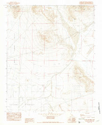
1982 Map of Grand View Mine
USGS Topo · Published 1982About this map
Grand View Mine and other high-elevation extractions define this rugged portion of the Ord Mountains during the early 1980s. The landscape is dominated by the prominent peaks of West Ord Mountain and East Ord Mountain, which rise sharply above the southern expanse of North Lucerne Valley. The map records a classic High Desert mining landscape, featuring the Ford Mine and Riley Mine alongside numerous scattered prospects. This 1982 provisional edition details the transition from the arid floor of the Lucerne Valley to the steep, mineral-rich slopes of the range, offering a precise look at the dirt tracks and remote worksites used by late-century miners and prospectors.
Find a feature on this map
11 named features on this map. Tap any name to fly to it.
Don’t see what you’re looking for? This feature index may not catch every label — zoom into the map to look around manually.
Map Details
Editions of this 1982 Grand View Mine Map
3 editions found
Other maps of this area

1901 · Southern California Sheet No. 1
USGS Topo · 1:250,000

1902 · San Gorgonio
USGS Topo · 1:125,000

1904 · Southern California Sheet No. 1
USGS Topo · 1:250,000

1947 · Lucerne Valley
USGS Topo · 1:62,500

1949 · Lucerne Valley
USGS Topo · 1:62,500

1953 · San Bernardino
USGS Topo · 1:250,000

1955 · Old Woman Springs
USGS Topo · 1:62,500

1955 · Ord Mountains
USGS Topo · 1:62,500

1955 · Rodman Mountains
USGS Topo · 1:62,500

1956 · San Bernardino
USGS Topo · 1:250,000