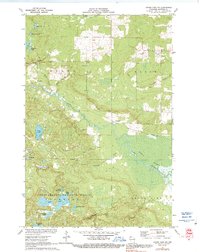
1971 Map of Grand View NW
USGS Topo · Published 1991About this map
Bibon Marsh dominates the southeastern terrain of this quadrangle, where the White River winds through a complex wetland system. In the northern reaches, the landscape is defined by the headwaters of the North Fork Fish Creek and South Fork Fish Creek, as well as numerous glacial lakes including Deep Lake and Sawmill Lake. The settlement at Sutherland sits near the crossing of an Old Railroad Grade, which provides a clear line of historical transit through the forest. Evidence of early community infrastructure is found at the Townhall near Pike River, while spiritual and commemorative sites like Bethany Ch and Pike River Cem offer points of interest for local historians. Large portions of the southern map area fall within the Chequamegon National Forest, featuring a cluster of smaller bodies of water such as Anodanta Lake and Drummond Lake.
Find a feature on this map
41 named features on this map. Tap any name to fly to it.
Don’t see what you’re looking for? This feature index may not catch every label — zoom into the map to look around manually.
Map Details
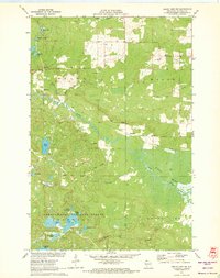
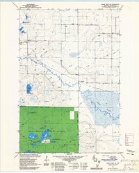
Editions of this 1971 Grand View NW Map
3 editions found
Other maps of this area

1943 · Iron Lake
USGS Topo · 1:48,000

1944 · Moquah
USGS Topo · 1:48,000

1944 · Drummond
USGS Topo · 1:48,000

1944 · Grandview
USGS Topo · 1:48,000

1947 · Drummond
USGS Topo · 1:48,000

1947 · Moquah
USGS Topo · 1:48,000

1947 · Iron Lake
USGS Topo · 1:48,000

1947 · Grandview
USGS Topo · 1:48,000

1953 · Ashland
USGS Topo · 1:250,000

1958 · Ashland
USGS Topo · 1:250,000