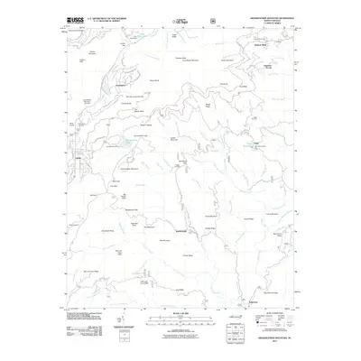
2011 Map of Grandfather Mountain
USGS Topo · Published 2011About this map
Grandfather Mountain Lake Dam and the Mile High Swinging Bridge anchor this high-elevation study of the Blue Ridge terrain during the early 21st century. The map details a complex network of local roads and recreational sites, such as Appalachian Camp and the residential clusters around Linville and Grandfather. This landscape is defined by its dramatic relief, featuring prominent landmarks like The Sphinx Rock, Beacon Heights, and the steep Big Lost Cove Cliffs.
Find a feature on this map
120 named features on this map. Tap any name to fly to it.
Don’t see what you’re looking for? This feature index may not catch every label — zoom into the map to look around manually.
Map Details
Editions of this 2011 Grandfather Mountain Map
This is the sole edition of this map. No revisions or reprints were ever made.
Other maps of this area

1893 · Cranberry
USGS Topo · 1:125,000

1895 · Cranberry
USGS Topo · 1:125,000

1899 · Cranberry
USGS Topo · 1:125,000

1902 · Cranberry
USGS Topo · 1:125,000

1905 · Morganton
USGS Topo · 1:125,000

1934 · Valle Crucis
USGS Topo · 1:24,000

1934 · Elk Park
USGS Topo · 1:24,000

1934 · Linville Falls
USGS Topo · 1:24,000

1934 · Boone
USGS Topo · 1:24,000

1934 · Newland
USGS Topo · 1:24,000